Rethinking the Last Mile in Dense Urban Cores
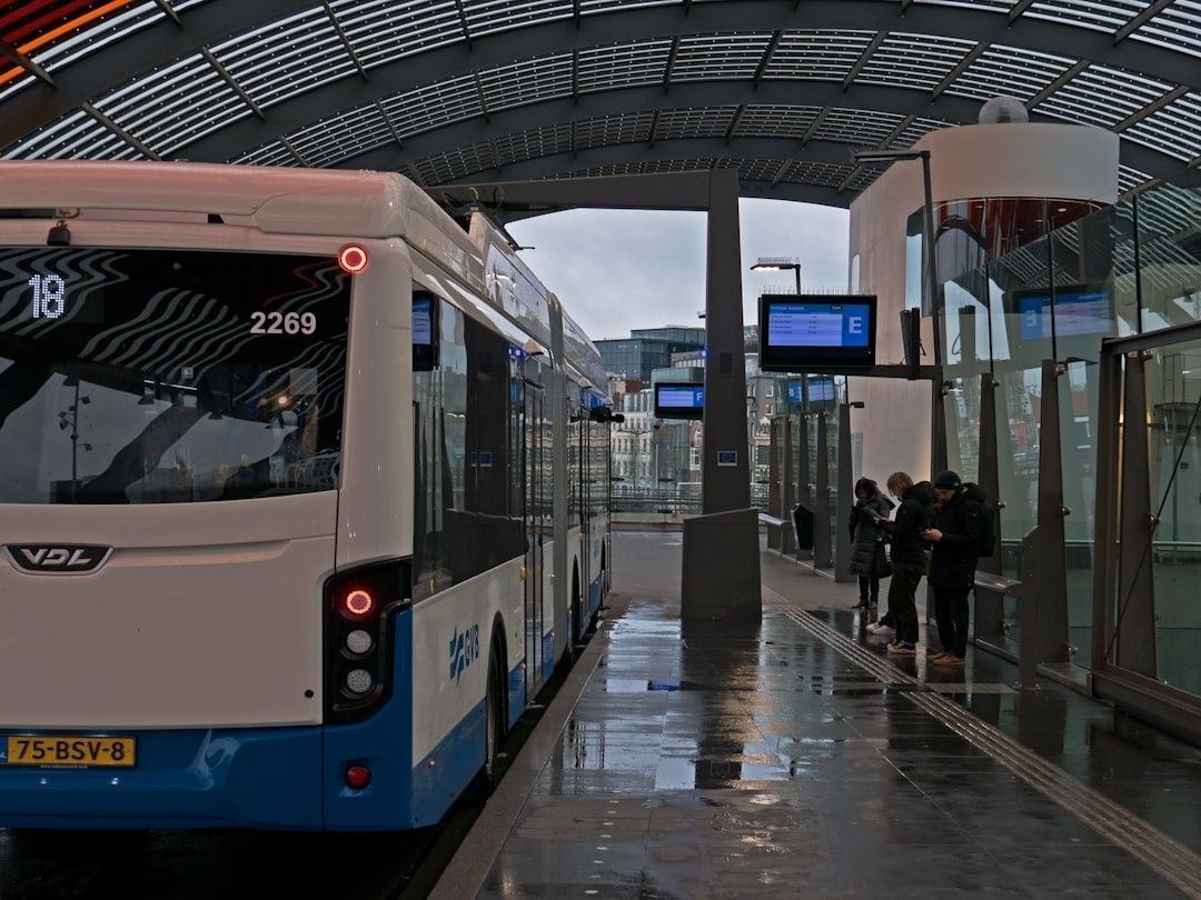
Downtown freight is essential to urban life, yet the way it is moved can make dense districts slower, noisier, and less healthy. Delivery vans and trucks often enter the same constrained streets as buses, cyclists, pedestrians, and emergency vehicles. Once there, drivers may circle for a legal loading space, idle while searching for a recipient, or stop in a travel lane when the curb is occupied. The result is not simply a delivery problem. It is a competition for scarce public space, with congestion and localized air pollution concentrated around the busiest neighborhoods.
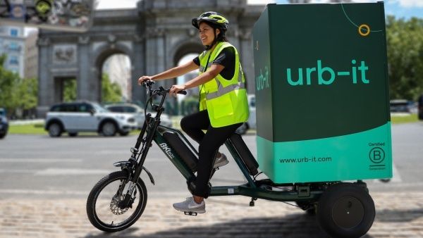
Micro-hubs paired with commercial e-cargo bikes offer a practical change in scale. Instead of asking a multi-ton vehicle to reach every doorway, a truck can transfer freight at a strategically located consolidation point. Smaller electric cycles then handle the final streets, using their maneuverability to reach destinations without blocking traffic or consuming an entire curb lane. This is the kind of small but mighty e-bike approach that treats mobility as a network of choices rather than a default dependence on large vehicles. Properly designed, the system can deliver goods faster while making downtown streets calmer and more usable.
How Decentralized Micro-Hubs Reshape Urban Freight Architecture
A micro-hub is a local transfer point where freight is received, sorted, and dispatched over a short distance. It might occupy part of a parking garage, an underused storefront, a loading area, or a modular container placed on public or private land. Its value comes from proximity. A truck reaches the hub once, ideally from a route that avoids the most constrained inner-city corridors, while cargo bikes, handcarts, and small electric vehicles complete the final distribution leg.
This arrangement separates two very different freight tasks. Long-distance or regional movement benefits from vehicle capacity and consolidated routing. Short urban deliveries benefit from maneuverability, frequent stops, and access to protected cycling infrastructure. New York City”s three-year microhub pilot illustrates the potential. According to reporting on the program, more than 3,000 truck trips had been eliminated more than a year into the pilot. Initial operations delivered approximately 860 packages per day by handcart and another 110 by cargo bike, while the program expanded from three Upper West Side locations toward the Financial District and Upper East Side.
The spatial gain is especially important. A conventional delivery van may occupy a curb space for several minutes at each stop, and the driver may need additional time to find that space. A cargo bike can often pull into a designated loading area, operate from a smaller footprint, and continue before the curb becomes a bottleneck. A hub also makes consolidation possible, reducing duplicated trips by different carriers serving the same buildings. The following comparison shows why the model matters to planners.
| Freight model | Typical urban pressure | Micro-hub alternative |
|---|---|---|
| Large truck or van to every address | Repeated inner-city vehicle entry, curb idling, and difficult turning movements | One perimeter or neighborhood transfer, followed by smaller delivery vehicles |
| Independent carrier routes | Multiple operators serving the same blocks with little coordination | Consolidated dispatch and shared local distribution capacity |
| Unmanaged curb stopping | Double-parking, blocked bike lanes, and pedestrian conflicts | Scheduled loading spaces and predictable short-duration access |
| Vehicle-sized delivery infrastructure | Large land requirement and poor fit with dense neighborhoods | Flexible use of garages, storefronts, containers, and existing public assets |
The model is not automatically successful. Hub placement must reflect delivery density, property access, security, fire codes, and the availability of safe routes. A poorly located hub simply moves the congestion problem to another block. Strong pilots therefore measure truck trips avoided, cargo-bike utilization, failed deliveries, curb dwell time, energy use, and neighborhood impacts rather than counting only packages delivered.
Regulatory Frameworks and Urban Permitting in Action
Commercial cargo cycles need rules that are as clear as those governing vans, even though their physical and environmental impacts are different. Cities must define permissible width, power output, equipment, parking locations, loading behavior, and access to protected cycling facilities. Without that clarity, businesses face uncertainty and enforcement agencies must improvise. That can discourage investment in specialized fleets and create conflict with pedestrians or conventional cyclists.
Seattle provides a useful example through its commercial e-cargo bike permitting system. Eligible vehicles may have two, three, or four wheels, must be no wider than 48 inches, and must have operable pedals with a maximum power output of 750 watts. Permitted bikes may use roadways and protected bike lanes and may park in certain loading, parking, and paid areas, while generally being restricted from sidewalks when curbside parking is available. Businesses also report package deliveries and miles traveled twice yearly, creating a basic accountability framework. The city”s official Commercial E-Cargo Bike Permits page sets out the operational requirements and application process.
Dedicated curb allocation is central to making the system work. Cargo bikes should not be forced onto sidewalks simply because no loading space exists, and loading zones should not become informal long-term storage areas. A city can use time limits, marked bays, digital permits, and enforcement data to protect pedestrian right-of-way while allowing efficient commercial access. Clear rules also give logistics companies confidence that a fleet purchased today will have predictable operating privileges tomorrow.
- Define maximum vehicle dimensions, power limits, lighting, braking, and safety equipment.
- Identify loading areas where cargo cycles can stop without blocking sidewalks or protected lanes.
- Specify when permitted bikes may use paid parking, commercial loading zones, or restricted streets.
- Require basic reporting on deliveries, mileage, incidents, and curb use.
- Coordinate permits with hub leases, freight contracts, and street design projects.
Municipalities can further reduce uncertainty by publishing maps, offering a single application portal, and providing technical assistance to smaller operators. Seattle”s fee waiver during 2026, followed by a stated fee of $100 per bike beginning in January 2027, illustrates how temporary incentives can lower the barrier to entry while a program matures. Predictable regulations do more than control behavior. They unlock private logistics investment by making vehicle purchases, staffing, and hub planning easier to justify.
The Operational Blueprint for Launching Micro-Logistics Systems
A successful launch begins with freight geography, not vehicle procurement. Planners should map delivery density, recurring commercial destinations, failed-delivery locations, curb occupancy, protected bike networks, pedestrian plazas, bridge crossings, and steep grades. The most promising first hub is usually close enough to dense demand to support rapid cycling, while remaining accessible to inbound trucks and secure enough for temporary package storage.
New York City”s experience also shows the importance of an incremental approach. A pilot can begin with a limited number of hubs and a defined group of delivery partners, then expand after measuring truck trips replaced, packages handled, delivery times, and public-space effects. The objective is not simply to substitute one vehicle for another. It is to redesign the sequence from regional freight arrival to final doorstep access.
- Identify staging zones. Select locations near concentrated delivery demand, available loading access, and protected or low-stress cycling routes. Include garages, vacant retail space, public facilities, and private lots in the site search.
- Match fleets to freight. Balance payload capacity, weather protection, turning radius, battery range, security, and rider ergonomics. Two-wheel cycles may suit narrow routes, while three- or four-wheel models can provide greater stability and volume.
- Build charging resilience. Install secure charging areas and assess battery-swapping options for high-utilization fleets. Multi-operator hubs need clear protocols for access, electrical capacity, battery ownership, fire prevention, and maintenance.
- Optimize routes for real street conditions. Routing software must account for bike paths, one-way restrictions, pedestrian plazas, steep terrain, construction, access hours, and legal loading locations. The fastest motor route is not necessarily the fastest practical cycle route.
- Measure and refine. Track delivery time, curb dwell, vehicle miles traveled, energy use, incidents, failed deliveries, and customer experience. Expand only after operational data shows that the hub is reducing pressure rather than relocating it.
Battery management deserves particular attention. A fleet that is theoretically zero-emission but frequently sidelined by depleted batteries will push operators back toward vans. Charging rooms should be secured, ventilated, and designed around the duty cycle of the fleet. Shared facilities should define who may charge, when, and how costs are allocated. Standardized connectors and transparent access rules can prevent a hub from becoming a collection of incompatible systems.
Route design should also respect the human texture of downtown streets. Cargo cycles need room to maneuver, but pedestrian plazas and transit stops cannot be treated as unrestricted shortcuts. Delivery windows, low-speed operating rules, and loading points at the edge of sensitive public spaces can preserve access while reducing conflicts. The strongest systems combine digital optimization with local knowledge from riders, building managers, disability advocates, merchants, and residents.
Beyond Cargo to Broad Urban Access and Cleaner Air
Commercial freight is only one demonstration of what electrified pedal-assist mobility can accomplish. Cargo cycles can support maintenance crews, community services, mobile technicians, food access programs, and small businesses that need reliable short-distance transport without a van. Their usefulness is especially clear where parking is scarce, distances are moderate, and workers need a flexible vehicle rather than a large enclosed cabin.
Colorado”s Can Do Colorado e-Bike Pilot offers evidence that electric bicycles can broaden transportation access beyond recreational use. Led by the Colorado Energy Office with the National Renewable Energy Laboratory, the nearly two-year program distributed about 200 e-bikes and 50 e-bike-share memberships to low-income essential workers in diverse locations. Participants used e-bikes for 28% of all trips, often for employment-related travel, and the program estimated nearly 40 megawatt-hours of energy savings compared with single-occupancy vehicles. The findings are detailed in Small But Mighty: Electric Bicycles Can Bridge the Gap in Access to Transportation.
For freight planners, the lesson is not that every trip belongs on a bicycle. Distance, weather, disability, family responsibilities, road quality, and payload all matter. The lesson is that many trips currently assigned to cars and vans fall within a practical e-bike range, especially when infrastructure and secure parking are available. Replacing combustion vehicles in dense neighborhoods can reduce localized nitrogen oxides and particulate pollution, while fewer large vehicles also reduce noise and street-safety risks.
- Cleaner air near schools, housing, shopping streets, and transit corridors.
- Fewer large vehicles entering narrow streets and making complex turns.
- Safer conditions for pedestrians, cyclists, wheelchair users, and older residents.
- More reliable access for essential workers and small businesses.
- Street designs that support both freight efficiency and everyday active travel.
Infrastructure built for cargo cycles often benefits every vulnerable road user. Protected intersections, smoother surfaces, wider cycle tracks, secure parking, and carefully designed loading areas make ordinary cycling and mobility-aid travel more comfortable as well. The result is a virtuous cycle: better access supports more use, more use strengthens the case for investment, and stronger networks make car-free and car-light trips easier to choose.
Building Human-Scale Freight Networks for Tomorrow
Replacing repeated trips by multi-ton delivery vehicles with lightweight e-cargo cycles is becoming an operational necessity in crowded downtowns, not a novelty reserved for showcase projects. As freight demand grows, adding more vans to constrained streets will produce diminishing returns. Micro-hubs offer a way to preserve the capacity of consolidated trucking while shifting the most space-sensitive part of the journey to vehicles designed for dense neighborhoods.
Scalable results require cooperation among city halls, logistics companies, property owners, retailers, workers, and residents. Municipalities can provide clear permits, curb allocation, safe cycle networks, and suitable hub sites. Operators can share performance data, improve loading discipline, and design fleets around actual delivery patterns. The payoff is a more resilient local supply chain, calmer curbsides, cleaner air, and downtown streets where movement and commerce support one another instead of competing for every available meter.